



Yonaguni: Underwater “Pyramid” or Geological Masterpiece?
Off the coast of Yonaguni Island at the westernmost tip of Japan lies an underwater rock formation featuring remarkably flat planes, steps, and sharp angles. Such geometry has led many to call it a ruin, while geologists point out that natural bedding planes and joint fractures can form similar structures.
Diver Kihachiro Aratake discovered this formation in 1986 while looking for a good spot to observe hammerhead sharks. The main monument lies at a depth of about 25 meters, composed of bedded sandstone and mudstone. Strong currents, weathering, bedding planes, and joint systems all act upon the rock mass.
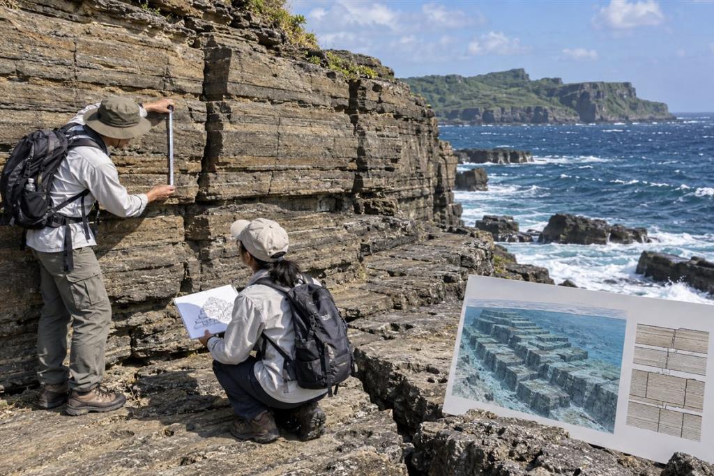
Why Does It Look Like a Structure?
Nearly horizontal beds create stepped surfaces, while vertical joint fractures form right angles. When rock between fractures breaks away, the remaining portions can resemble staircases, courtyards, and walls. The human brain is particularly adept at spotting intentional design in regular lines, so photographs taken from favorable angles easily reinforce the impression of architecture.
The Argument for Human Modification
Some researchers argue that certain grooves, detached blocks, and arrangements are difficult to explain entirely by erosion, suggesting it could be a modified natural landform. This hypothesis requires tool marks, artifacts, habitation sediments, or associated dating. To date, no such evidence has gained archaeological consensus.
Comparison with Onshore Geology
The terrestrial cliffs of Yonaguni above water also exhibit flat bedding, rectangular joints, and sharp-edged detached blocks. This comparison provides an observable mechanism within the exact same geological setting. While it does not prove that every underwater feature is entirely natural, it places the burden of proof on claims of artificial architecture.
Sea Levels and Dating Are Inconclusive
The area was exposed when sea levels were lower at the end of the Ice Age, making human access theoretically possible. However, “accessible” is not the same as “constructed.” Calling this a city requires a coherent body of independent cultural evidence rather than merely rock shapes and sea-level reconstructions.
Unanswered Questions
- No systematic archaeological surveys or sufficiently comprehensive data publications have been completed to close the debate.
- Some surfaces may have been both naturally formed and later used or slightly modified by humans.
- Photos and videos often select striking angles, making it difficult for viewers to assess the full three-dimensional terrain.
Conclusion
The natural explanation based on bedding planes, fractures, and erosion currently relies on fewer assumptions. While the possibility that humans once used or partially modified the site cannot be entirely ruled out, calling Yonaguni a pyramid or a sunken city remains unsupported by archaeological evidence.



 Korean kimchi and banchan: the craft of fermentation and a table built on sharing
 Persian rice and tahdig: saffron, a crisp bottom layer and the sofreh
 Moroccan couscous and tagine: rhythm, hospitality and the flavours of North Africa
 Brazilian feijoada: a pot of black beans, a weekend lunch and a story with many roots
 The Indian thali: a balanced tray that tells a regional story and a way of eating together
 Danish smørrebrød: the open sandwich and the art of composing a lunch
 Swiss raclette: melted cheese and a shared table in the cold season
 Injera in Ethiopia and Eritrea: the shared platter that binds a community
Đăng nhập để bình luận: / Sign in to comment: